 |
|||||||||||||
|
|
|||||||||||||
 |
|||||||
|
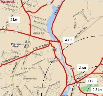
Areas Impacted by Route 92 On the home page are maps that show how 92 would impact the environmentally sensitive land within South Brunswick Township. Here we show some other areas that 92 would also harm. West of the Western Terminus
The boundary for the Army Corps of Engineers DEIS exclude most of the roads to the west of 92’s western terminus. 92 traffic would not stop at Route 1, but would continue along these local roads. Lingston and Rocky Hill would be hurt the worst. Princeton Township would also be affected, even though Mayor Marchand supports Route 92. 92 traffic would impact many narrow local roads that cannot bear the added burden. Kingston, Rocky Hill, Montgomery, and Princeton Township roads would be the most directly impacted. Some 92 traffic would try to avoid the chronic traffic jams on Route 27 by using east-west local roads to the north. Route 92 would induce sprawl in this entire area, especially near the roads that most directly lead to or from it. Princeton University’s for-profit Forrestal development arm has strongly supported Route 92 because it would feed the sprawl that they have built or intend to build at the west end. (Think about it: if 92 couldn’t cause sprawl, would Forrestal care?) Not shown on this map is the planned extension of Route 92 into Montgomery. The Regional Planning Partnership is on record as favoring this extension, despite the fact that it illegally “segments” 92 to evade Federal environmental laws. “If every new road that the traffic engineers built actually reduced traffic, why do we have any traffic problems now?” -- Frank Gambatese.
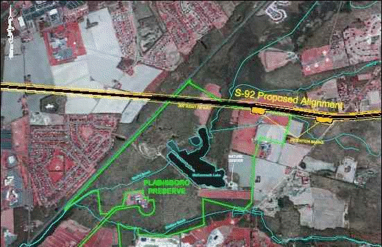
When Jim Jeffers and his family donated the land for the Plainsboro Preserve, he hoped that his gift would be preserved for the enjoyment of everyone in the region. Here, in his own words, are his concerns about what will happen to the Preserve if 92 is built:
Princeton Collection Also note the very close proximity of 92 to the homes of the Princeton Collection, to the immediate west of the Plainsboro Preserve. The noise pollution there will be the same as the Preserve. Can you help us stop 92?
|
|||||||

